|
About
Kamet |
|
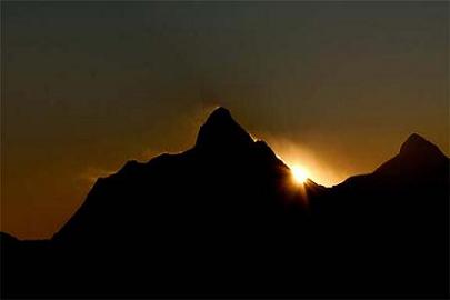
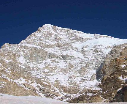
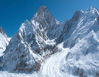
Kamet is the second highest mountain in the Garhwal region of
India, after Nanda Devi. It lies in the Chamoli District of
Uttarakhand, close to the border with Tibet. It is the third
highest mountain in Indian-controlled territory, although it
ranks lower if counting mountains inside Indian-claimed
territory in Pakistan, and it is the 29th highest in the
world. Kamet is most properly considered part of (and the
highest summit in) the Zanskar Range which lies north of the
main chain of the Himalayas, between the upper Karnali River
and the Suru River. In appearance it look likes a huge pyramid
topped by a flat summit area with two peaks. |
|
| |
|
Classification of Kamet |
|
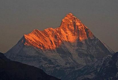
There
are varying explanations of the name “Kamet.” C. F. Meade claims
that it is known to Tibetans as Kangmen, signifying “huge
grandmother of a sacred snow chain”. However, Frank Smythe
writes in his book Kamet defeated that the origin of the name is
from the Tibetan word Kangmed ("the lower snows", from kang,
“snow”, and med, “little”), as distinct from the “higher snows”
of the Kailash range which is 110 miles east of Kamet. (This
range is slightly lower than Kamet, its highest peak being Gurla
Mandhata which is 7,728 m/25,355 ft in height; however it stands
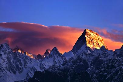
more fully on the high Tibetan Plateau). At dawn and dusk, “the
copper colored rock of Mount Kamet reflects the oblique rays of
the sun on its hanging glaciers appears to set these glaciers
glowing with crackling flames and cleans the mountain in a red
burning glow”. Hence the term “glacier fire” is also used as a
reference to the name Kamet. |
|
| |
|
Neighboring and Subsidiary Peaks |
|
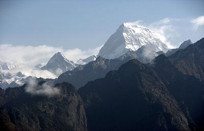
Kamet
is surrounded by three principal neighboring or subsidiary
peaks:
Abi Gamin
Abi Gamin is 7,355m (24,130 ft), its prominence is 217 m, it
lies at 30°55′57″N 79°36′09″E, north-northeast of Kamet; it is
connected to Kamet by Meade’s Col. Its first ascent was done in
1950.
Mana
Mana is 272m (23,858 ft), it ranked 92nd, its prominence is 720
m, it lies at 30°52′52″N 79°36′57″E, south-southeast of Kamet.
Its first ascent was done in 1937.
Mukut Parbat
Mukut Parbat is 7,242 m (23,760 ft) in height, it is ranked
97th, its prominence is 840 m, it lies at 30°57′08″N 79°34′13″E,
northwest of Kamet. Its first ascent was done in 1951 . The
lower of Mukut Parbat's twin summit has an elevation of 7,130 m
(23,392 ft).
Several adjoining peaks, such as Bidhan Parbat, 6,519 m Mana NW,
7,092 m, Point 6,977 m, and Deoban, 6,855 m, also lie close to
Kamet. |
|
|
|
|
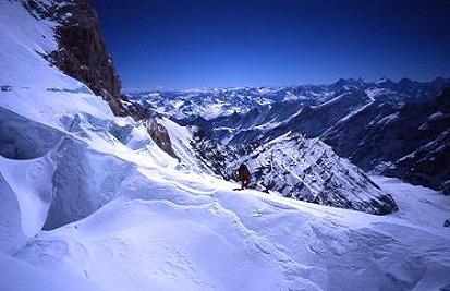
Climbing |
|
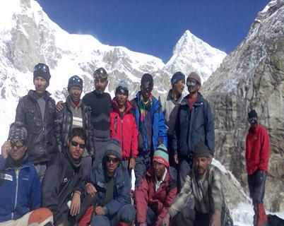
Due to its position near the Tibetan Plateau, Kamet is
remote and not as accessible as some Himalayan peaks. It
also receives a huge deal of wind from the Plateau.
However, by modern standards, it is a comparatively
straightforward ascent for such a high mountain. Early
explorers of the region faced long approach marches of
about 200 miles from Ranikhet through dense mountain
forest; access is easier today.
While attempts to climb Kamet began in 1855, the first
ascent was not made until 1931 by Eric Shipton, R.L.
Holdsworth, Frank Smythe, and Lewa Sherpa, members of a
British expedition. Kamet was the first summit over 25,000
ft (7,620 m) to be climbed, and was the highest summit
reached until the first ascent of Nanda Devi five years
later. However, far higher non-summit altitudes had been
reached on the north side of Mount Everest in the 1920s.
The standard route begins from the East Kamet (or Purbi
Kamet) Glacier, ascending via Meade's Col which is 7,100m
high, the saddle between Kamet and its northern outlier
Abi Gamin. From Meade's Col the route ascends the
northeast edge of the north face. The climb to Meade's col
involves steep gullies, a rock wall, and some glacier
climbs. Five camps are generally placed en route. The
final ascent to the summit involves steep snow, possibly
icy. |
|
|
|
|
Glaciers and Rivers |
|
The
East (Purbi or Purva) Kamet Glacier, the West (Pachmi or
Paschimi) Kamet Glacier and the Raikana Glacier systems surround
Kamet. The branches of the West Kamet Glacier start on the
western slopes of Kamet, Mukut Parbat, and Abi Gamin. The East
Kamet Glacier flows from the eastern side of Mana and Kamet. The
Raikhana glacier originates on the east side of Meade’s Col
saddle, flows east of Abi Gamin, and unites with the East Kamet
Glacier. The West Kamet Glacier drains into the Saraswati River
while the East Kamet Glacier feeds the Dhauliganga River; both
rivers are tributaries of the Alaknanda River, the major river
of the Chamoli district. |
|
|
|
|
High Altitude Research |
|
A. M.
Kellas and his companion H. T. Morshead conducted scientific
studies during their 1920 Kamet expedition focusing on the
physiology of high altitude travel and acclimatization, and on
the possibility of using supplemental oxygen. These studies
ultimately proved useful on expeditions to Mount Everest. |
|
|
|
|
|
|
|
|
|