|
About
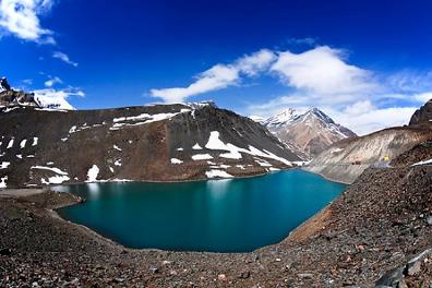
Suraj Tal |
|
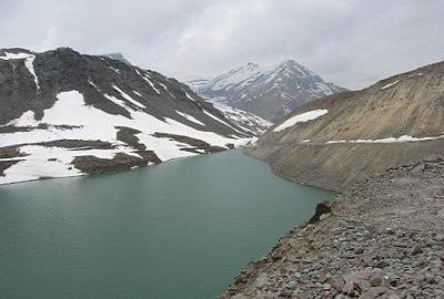
Suraj Tal or
Suraj Tal Lake also called Surya taal, is a sacred body of
water, it literally means the Lake of the Sun God, and lies
just below the Bara-lacha-la pass (4,890m) (8 km in length) in
the Lahaul and Spiti valley of Himachal Pradesh state in India
and is the third highest lake in India after Cholamu, and the
21st-highest in the world.Suraj Tal Lake is the source of
Bhaga River which joins the Chandra River downstream at Tandi
to form the Chandrabhaga River in Himachal Pradesh territory,
and as it enters Jammu and Kashmir it is renamed as the Chenab
River. The Bhaga River (a tributary of the Chandrabhaga or
Chenab) originates from Surya taal. The other major tributary
of the Chandrabhaga, the Chandra originates from the glacier
close to the Chandra Taal lake in the Spiti district.
|
|
| |
|
Suraj Tal Lake
-Lahaul-Spiti |
|
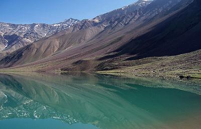
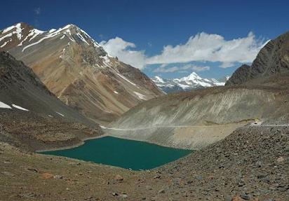
The holy water
body Suraj Tal means the Lake of the Sun God which is situated
in the Upper Himalayan Zone of Lahaul and Spiti valley in
Himachal Pradesh. Suraj Tal Lake lies just below to the Bara-lacha-la
pass of Zanskar range in Leh-Manali highway. There is a number
of lakes in Himachal Pradesh some of the high altitude lakes
are Chandra Tal (4300m), Dashair (4270m), Brighu Lake (4235m),
Mahakali Lake (4080m) and Chander Naun (4260m). Reservoirs are
Maharana Pratap Sagar, Pandoh Lake and second largest
reservoirs of India Guru Gobind Sagar.
Suraj Tal Lake
is a unique and charming lake which is one of the most
beautiful states of India. This lake has an amazing
surrounding of white layered (at specific time of the year)
and gentle sloped mountains which attracts many trekkers to
this region. The lake is located 4950 m below the summit of
the Baralacha pass in the Lahaul region of Spiti and Lahaul
district. It’s the source of Bhaga River, and is considered
sacred. It’s visited by devotees and tourist particularly in
the summer season.
|
|
| |
|
Physical
description |
|
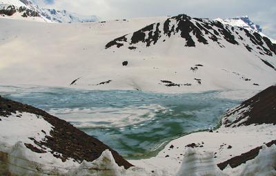
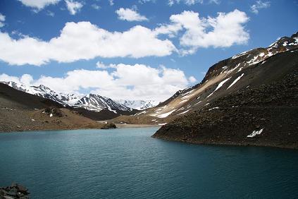
Terrain
The lake is fed
from the glaciers and torrential nullahs (streams) originating
from the Bara-lacha-la pass, which is 8 km long and is also
called the "Pass with crossroads on summit" since roads from
Zanskar, Ladakh, Spiti and Lahaul meet at this pass. In
addition to the Suraj Tal and the Bhaga River that originates
from it, Bara-lacha-la Pass is also the source of the Chandra
and Yunan Rivers in the northwest and north, respectively.
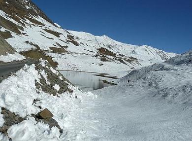
The lake is
situated in the Upper Himalayan Zone or High Latitudinal Zone
part of the Himalayas which has very sparse population with
climatic conditions similar to polar conditions. Snowfall in
this zone, though scanty, is reported to be spread all round
the year. Rainfall precipitation is rare in the region. Snow
precipitation from snow storms is reported to be less than 20
cm of snow in nearly 50% of the storms, even though one
observatory in the region has reported 80 cm of snow fall.
The
precipitation starts melting from May. Snow on slopes is
generally slackly bonded, with wind redistributing it. The
average total snowfall recorded in a year is reported to be 12
m–15 m with temperatures of Highest Max. 13 °C, Mean Max.0.5
°C, Mean Minimum minus 11.7 °C and Lowest Minimum of minus 27
°C (80.6 °F). The ground in the zone is covered with scree and
boulders.
|
|
|
|
|
Geology |
|
The Lake's
geology is represented by the Bara-lacha-la Pass, which is
reported to be an early rifting event on the northern Indian
passive margin and that the Basalts which are emplaced along
the trans–tensional faults indicate that.
Bhaga Valley
The Bhaga Valley
(Tod or Stod Valley) is formed from Suraj Tal up to Tandi, the
convergence point with Chandra River, is 64 km long. The
valley, which is a narrow gorge, is devoid of any vegetation
up to Darcha and thereafter it widens up to its convergence
with Chandra River at Tandi with terraces between Darcha and
Tandi which are under cultivation in the lower slopes, with
the middle slopes having grasslands. Plantation of trees and
shrubs to meet fuel wood and fodder requirements have been
done on the hill slopes.
|
|
|
|
|
Tourism |
|
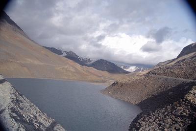
Lahaul Spiti
valley is a common destination for Indian and foreign tourists
for road trips, trekking and motorcycling which cover the Lake
and the Bara-lacha-la pass, en route from Manali to Leh.
Trekking
Trekking tours
are a common feature. One such trek route is the
Zingzingbar–Suraj Tal–Bara-lacha-la, which involves trek along
the Bhaga River for 3 km , cross a bridge to the North bank,
then a further climb of 2.5 km from the bridge followed by a
steep foot trail up to Suraj Tal.
Biking tours
Motorcycle trips
during the season when the area is approachable are undertaken
by tourists. During such trips from Manali to Leh, the section
between Patseo to Bara-lacha-la is a rough journey of 30 km.
Along this route, two small lakes, the Deepak Tal and the
Suraj Tal are seen.
|
|
|
|
|
Access |
|
Suraj Tal is 65
km from Keylong, the district headquarters of the Lahaul Spiti
district, a frontier district of India which is accessible by
road by the National Highway NH 21, also known as the
Leh-Manali Highway. The NH 21 is the vital road link for the
people living in the Lahaul Spiti district. The road skirts
the Suraj Tal and is just 3 km short of the Bara-lacha-la
pass. It is sometimes falsely claimed to be the highest
mountain road in the world but it remains unreachable from
Rohtang Pass to Leh during winter months of November to April
since the pass becomes totally snowbound during this period.
|
|
|
|
|
|
|
|
|
|