|
|
|
Nubra Valley |
|
|
Information about Nubra Valley
The Nubra Valley, once on the trading route that connected
eastern Tibet with Turkistan via the famous Karakoram Pass has
been opened recently to the tourists. The Nubra Valley
literally means the valley of flowers. Nubra Valley is
situated in the north of Leh. The average altitude of the
valley is about 10,000 feet above the sea level. The Khardong
village, Khalser and Deskit are the main villages of Nubra
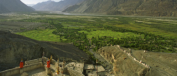
valley. At first glance, the valley seems parched and dry, but
this is prime farming land by Ladakhi standard. Here the
farmers grow apples, apricots and barley and harvest the
orange berries of the Tsetalulu. Dotted around the valley are
ancient gompas and ruined palaces and villages are close
enough together to make this magnificent walking country. The
people of Nubra Valley are friendly and hospitable. The Nubra
Valley is indeed a precious treasures of Ladakh where people
still living in the complete isolation for most of the year
from rest of the world in the heart of the great Himalayas.
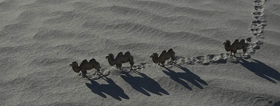
The main attraction of the Nubra valley is Bactarian Camels
(double hump Camel). These camels can be seen around sand
dunes. Other attractions include Deskit, Samstanling
monasteries and Khardung la Pass (18,380 feet) above sea
level. For tourists its ideal to spend here two to three
nights. However, you do need a permit, which only allows
travel as far as Hunder and Panamik for a maximum of seven
days. You must handover the photocopies of your permit on both
sides of the Khardung La and also by the bridge to Sumur. |
|
|
 |
|
|
|
Tourists Attractions in
Nubra Valley
The main tourist attractions in the Nubra Valley are
Diskit, Panamik, Samstanling monasteries and Khardung la Pass.
People traveling to Nubra Valley are advised to take enough
eatables and drinking Water etc. as people in the valley do
not have much to offer you from their winter reserves. On the
way most of the vehicles you meet are the Indian Army trucks. |
|
|
|
Diskit
Diskit is the main habitation and administrative center of the
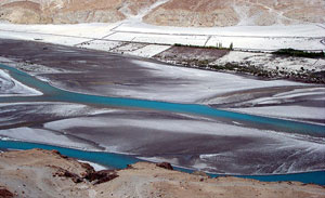
Nubra Valley. Sprawling over the floodplains on the south
banks of the Shyok river, Diskit is situated on the edge of a
desert on the Shyok-side valley. Due to unmatchable beauty of
this valley, an excursion made here in unforgettable. The
valley surrounded by the Himalaya mountains offers spectacular
views. While descending into the valley after a few kilometers
one would come into a surprisingly green landscape with high
stone formations appearing like if sugar was poured over them.
In the valley the landscape changes from the green oasis to
desert. The main habitation, the town of Diskit makes an
impression of being rather an empty town. There are several
government offices in addition to the usual cluster of the
whitewashed farmhouses. The Diskit village offers Guest Houses
and lower budget hotels. The main attraction here is the 17h
century Diskit Gompa, reached by the winding road or the dirt
track starting near the stream in the middle of the village.
Some stone steps climb to the main prayer hall, which
enshrines a huge Maitreya statue and a giant drum. Upstairs is
a dramatic lookout and a second chamber with effigies of
demonic protectors. The gompa holds a major festival of
Dosmoche in February. Downhill is the photang of the head lama
of Nubra, dwarfed by the enormous statue of Chamba.
|
|
|
|
Hunder
Beyond Diskit, the highway passes through a wide area of
rolling sand dunes before reaching the sprawl of
farmhouses and scrubby trees at Hunder. The foreigners
can only travel as far as the bridge at the west end of
the village. Immediately before the bridge is the squat
Hunder Gompa, containing a large gilded statue of the
Chamba. Across the road, a crude trail claims to two
crumbling Buddhist temples |
 |
|
|
and the ruins of a vast
compound of pilgrims quarters. The fort at the top of the
bridge offers inspirational views, but the exposed scramble up
here is not for the fainthearted. The Camel safari can be
organized from Diskit to Hunder village. The Safari takes
around two hours. Hunder village has small monastery and it is
located on ancient Silk Route.
Sumur
On the far side of the valley, another dramatic gorge runs
north along the Nubra river. Sumur is the largest village
here, a pretty, green settlement with some interesting
Buddhist relics. About 1 km uphill from Sumur is the huge
Samstemling gompa, with a school full of friendly novice monks
and a number of old and modern prayer halls full of quite
distinguished murals. Further north on the main road is the
small village of Tegar, with a small, adobe gompa enshrining a
giant prayer wheel. Above the road are the burnt out ruins of
the Zamskhang palace,a former residence of the kings of Nubra,
surrounded by the tiny stupas filled with thousands of votive
clay tablets left here by pilgrims on the Silk Road. There is
another medieval gompa a few kilometres north at Pinchimik.
Panamik
Panamik is situated about 28 ksm. north of Sumur. The farthest
place the permit allows one to visit in the valley is Panamik,
the last settlement of any size before the Tibetan border.
Panamik is the most northern point open to foreigners in
India. Further to that, the sensitive military area starts.
The soldiers guarding the border are friendly and are happy to
see the visitors too. The hot springs of Panamik are also
worth visiting as to feel the warm water which is rare and
valuable in the area. |
|
|
 |
|
|
|
Ensa Gompa
The Ensa Gompa is 250 years old and lies on the top of a rock
and overlooks the snow-peaked mountains of the valley. This
Gompa seems not very far away but one needs to walk 6 to 7
hours to reach the Gompa.
Best Time to Visit Nubra Valley
The Nubra Valley can be visited only during the summer months
from mid of May till August. The Nubra valley itself lies at a
lower elevation than the Leh which makes it fertile unlike
most of the areas in Ladakh. In the valley, grains and fruits
like peaches are being cultivated and grown here.
How to reach Nubra Valley
The road journey to Nubra valley leads through Khardungla (the
highest motor able road in the world) situated at 18380 feet.
Beyond the pass is the wide, flat Nubra Valley, crisscrossed
by the winding channels of the Shyok and Nubra rivers. The
total distance of around 150 km from Leh to Diskit which is
also the administrative headquarter can be covered by the
state buses. Jeeps give you the freedom to stop wherever you
want and are recommendable. The roads are maintained and
guarded by the Indian army and sudden changes in the weather
and short term road blockage are common. One should be
prepared to face natural hazards as and when visiting Nubra
Valley. |
|