|
About
Baspa River |
|
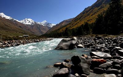
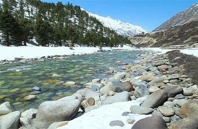
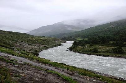
Baspa River rises near the Indo-Tibetan border and forms the
Baspa Valley (also known as the Sangla Valley) which is one of
the most beautiful in Himalayas. The Chung Sakhago Pass lies
at the head of the valley. It is fed by the persistent
glaciers and shares the catchment area with the Ganges.
Baspa starts at the Baspa hills, joins Sutley River from the
left bank near Karcham.The upper and middle slopes of the
valley along the river are covered with oak and pine forests.
Pastures, meadows and fields cover the lower slopes. Some of
the most scenic villages in the Himalayas can be found here.
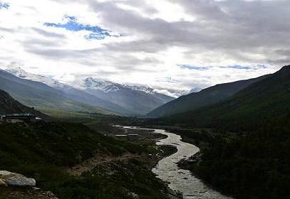
Only the lower half of the 95 kilometers length of the valley
is occupied - all the way from Chitkul (3,475 m) to where the
Baspa meets the Sutlej River at Karcham (1,830 m).Although
gentle most of the way, it would be difficult to raft in Baspa
as some extends have sheer falls.
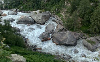
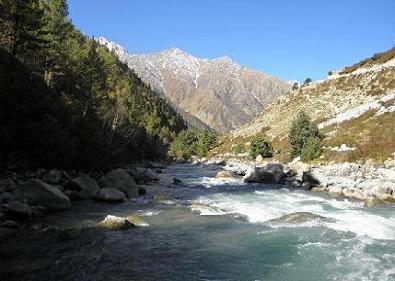
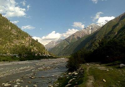
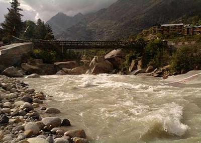
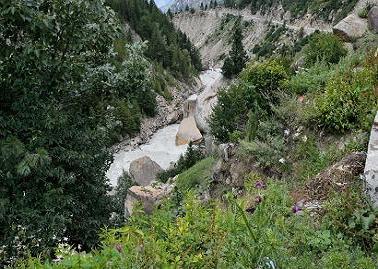
The Baspa River is a fast flowing river that passes though the
hills of Sangla. The surroundings of Baspa River provide an
opportunity to view timely rainbows and brown trout. It is
also an angler’s heaven for being home to a huge variety of
fishes. Crossing this river is also an attraction among the
visitors as this process involves ride in a basket along the
way. Its adjacent areas also stand appropriate for trekkers
and campers.
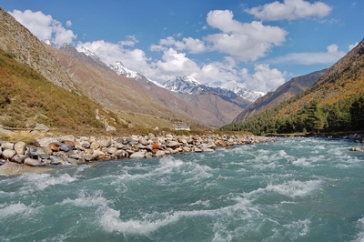
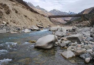
The Baspa river, the another feeder of the Satluj, rises on
the north eastern declivity of the outer Dhauladhar of the
Himalaya. It is a big and valuable streamwhich runs smoothly
down a famous valley. It is bounded on the south-west by the
Dhaola Dhar and on the north-east by the huge Raldang peak of
the Great Himalaya. The channel of the river is wide.
At Chhitkul its width is about twenty meters, lower down, the
width is from twenty-three to twenty-five meters. After
coursing in a north westerly direction it falls into the
Satluj at Karchham. The Baspa is next to Spiti in size and is
about seventy-two km in length. Its whole course lies within
the district. As compared to other rivers the Baspa is quite
turbulent and often changes its course thus doing extensive
damage to the cultivated fields on its bank. It receives the
various streams and streamlets on both of its banks. On the
left side mentionable tributaries are Thatang, Rukti, Zupkia,
and Bering and on the right Suthi. This is the most inhabited
valley and there are now permanent bridges at many places. An
outlandship fish species known as brown trout (salmo fario) is
found in this river. |
|
| |
|
How To Reach Sangla |
|
By
Rail
The nearest Railway Station is at Shimla which is at a distance
of 194 Kms from Sangla. Shimla Railway Station is well connected
with Kalka Railway Station and with the cities like Gumman,
Kathleeghat,Sonwara, Barog, Summer Hill, Kandaghat, Taradevi and
Kumarhatti etc.
By Road
There are many ways to reach Sangla by road. It is 35 Kms from
Purbani, 37 Kms from Telangi, 42 Kms from Nachar, 143 Kms from
Kumarsain, 167 Kms from Banjar, 199 Kms from Bhuntar and 209 Kms
from Kullu through Himachal Pradesh State Road Transport
Corporation (HPSRTC) and some private travel services.
By Air
The nearest Domestic Airport is Jubbarhatti Airport, Shimla, 194
Kms from Sangla. The second nearest Domestic Airport is Bhuntar
Airport which is about three and a half hour drive from Sangla.
It is very well connected to many major cities of India like
Dharamshala, New Delhi, Bangalore, Mumbai, Chandigarh, Shimla
and Ahmedabad. |
|
|
|
|
|
|
|
|
|